Back to start Norwegian version of the blog
Some good old practical use of technic aid. Via Sindre's article I found QuickRoute and here you can add the GPS data and overlay it with a scanned picture.
See example below. here I also have drawed the route it though I was running. I always do that after a race, it's very helpful. So now I can compare my memory with the real stuff.
<continue below picture>
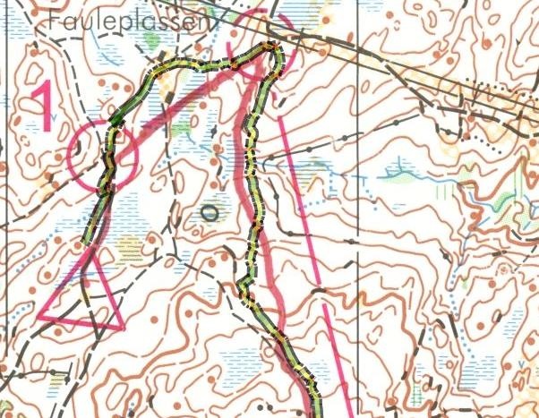
If you study the cource fra control 1 to control 2, there is some difference, and it's clear that I miss which cabin I was passing on the left side, so it's useful to have the corrected route.
The whole race is here : Høstløpet på Kongsberg